 Weather World

Bip, CT Weather Maps
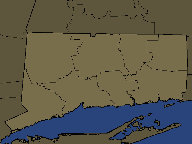
Bip, CT Regional Weather
Bip, CT
Day: Showers with a chance of thunderstorms this morning, then showers likely with a slight chance of thunderstorms this afternoon. Locally heavy rainfall possible. Highs in the upper 70s. East winds around 5 mph, becoming northwest around 5 mph this afternoon. Chance of rain near 100 percent.
Night: Partly cloudy. A slight chance of showers after midnight. Lows in the lower 60s. Southwest winds around 5 mph, becoming northwest with gusts up to 20 mph after midnight. Chance of rain 20 percent.
Oakville, CT
Night: Mostly cloudy with a chance of showers and thunderstorms. Not as cool. Near steady temperature in the lower 60s. Light and variable winds. Chance of rain 30 percent.
Northern New Haven, CT
Day: Showers with a chance of thunderstorms this morning, then showers with a slight chance of thunderstorms this afternoon. Locally heavy rainfall possible. Highs in the mid 70s. East winds around 5 mph, becoming north around 5 mph this afternoon. Chance of rain near 100 percent.
Night: Partly cloudy. A slight chance of showers after midnight. Lows in the lower 60s. Southwest winds around 5 mph, becoming northwest with gusts up to 20 mph after midnight. Chance of rain 20 percent.
Putnam, NY
Day: Cloudy with showers with a chance of thunderstorms this morning, then partly sunny with a chance of showers this afternoon. Locally heavy rainfall possible this morning. Highs in the upper 70s. East winds around 5 mph, becoming northwest around 5 mph this afternoon. Chance of rain 90 percent.
Night: Partly cloudy in the evening, then mostly cloudy with a slight chance of showers after midnight. Lows in the lower 60s. Southwest winds around 5 mph, becoming northwest with gusts up to 20 mph after midnight. Chance of rain 20 percent.
Northern Westchester, NY
Day: Cloudy with showers with a chance of thunderstorms this morning, then partly sunny with a chance of showers this afternoon. Locally heavy rainfall possible this morning. Highs in the upper 70s. East winds around 5 mph, becoming northwest this afternoon. Chance of rain 90 percent.
Night: Partly cloudy. A slight chance of showers after midnight. Humid with lows in the lower 60s. Southwest winds around 5 mph, becoming northwest after midnight. Chance of rain 20 percent.
Pawling, NY
Night: Cloudy with a chance of showers and thunderstorms. Not as cool. Near steady temperature in the lower 60s. South winds around 5 mph. Chance of rain 40 percent.
Torrington, CT
Night: Mostly cloudy with a chance of showers and thunderstorms. Not as cool. Near steady temperature in the lower 60s. Light and variable winds. Chance of rain 40 percent.
Southern Fairfield, CT
Day: Showers with a chance of thunderstorms this morning, then showers likely with a slight chance of thunderstorms this afternoon. Locally heavy rainfall possible. Highs in the upper 70s. East winds around 5 mph, becoming northwest this afternoon. Chance of rain near 100 percent.
Night: Partly cloudy. A slight chance of showers after midnight. Humid with lows in the lower 60s. Southwest winds around 5 mph, becoming northwest after midnight. Chance of rain 20 percent.
Southern New Haven, CT
Day: Showers with a chance of thunderstorms this morning, then showers with a slight chance of thunderstorms this afternoon. Locally heavy rainfall possible. Highs in the upper 70s. Southeast winds 5 to 10 mph, becoming northwest this afternoon. Chance of rain near 100 percent.
Night: Partly cloudy. A slight chance of showers after midnight. Humid with lows in the lower 60s. Southwest winds around 5 mph, becoming northwest with gusts up to 20 mph after midnight. Chance of rain 20 percent.
Poughkeepsie, NY
Night: Cloudy with a chance of showers and thunderstorms. Not as cool. Near steady temperature in the mid 60s. Light and variable winds. Chance of rain 40 percent.
Orange, NY
Day: Cloudy with showers with a chance of thunderstorms this morning, then mostly sunny with a slight chance of showers this afternoon. Highs in the upper 70s. Northeast winds around 5 mph, becoming west this afternoon. Chance of rain 90 percent.
Night: Partly cloudy in the evening, then mostly cloudy with a slight chance of showers after midnight. Lows around 60. West winds 5 to 10 mph with gusts up to 20 mph. Chance of rain 20 percent.
Southern Westchester, NY
Day: Cloudy with showers with a chance of thunderstorms this morning, then partly sunny with a chance of showers this afternoon. Locally heavy rainfall possible this morning. Highs in the upper 70s. East winds around 5 mph, becoming northwest this afternoon. Chance of rain 90 percent.
Night: Partly cloudy. A slight chance of showers after midnight. Humid with lows in the mid 60s. Southwest winds around 5 mph, becoming northwest after midnight. Chance of rain 20 percent.
Kingston, NY
Night: Showers likely with a chance of thunderstorms. Not as cool. Near steady temperature in the mid 60s. Light and variable winds. Chance of rain 60 percent.
Rockland, NY
Day: Cloudy with showers with a chance of thunderstorms this morning, then mostly sunny with a chance of showers this afternoon. Locally heavy rainfall possible this morning. Highs in the upper 70s. Northeast winds around 5 mph, becoming northwest this afternoon. Chance of rain 90 percent.
Night: Partly cloudy in the evening, then partly cloudy with a slight chance of showers after midnight. Lows in the lower 60s. West winds around 5 mph, becoming northwest with gusts up to 20 mph after midnight. Chance of rain 20 percent.
Northwest Suffolk, NY
Day: Showers with a chance of thunderstorms this morning, then showers likely with a slight chance of thunderstorms this afternoon. Locally heavy rainfall possible. Highs in the upper 70s. Southeast winds 5 to 10 mph, becoming northwest this afternoon. Chance of rain near 100 percent.
Night: Partly cloudy. Humid with lows in the mid 60s. West winds 5 to 10 mph.
Southwest Suffolk, NY
Day: Showers with a chance of thunderstorms this morning, then showers likely with a slight chance of thunderstorms this afternoon. Locally heavy rainfall possible. Highs in the upper 70s. South winds 5 to 10 mph, becoming west this afternoon. Gusts up to 20 mph. Chance of rain near 100 percent.
Night: Partly cloudy. Humid with lows in the mid 60s. Southwest winds 5 to 10 mph, becoming west 10 to 15 mph after midnight.
Northern Middlesex, CT
Day: Showers with a chance of thunderstorms this morning, then showers with a slight chance of thunderstorms this afternoon. Locally heavy rainfall possible this morning. Highs in the mid 70s. Southeast winds around 5 mph, becoming north this afternoon. Chance of rain near 100 percent.
Night: Partly cloudy in the evening, then mostly cloudy with a slight chance of showers after midnight. Humid with lows in the lower 60s. West winds 5 to 10 mph with gusts up to 20 mph. Chance of rain 20 percent.
Northern Nassau, NY
Day: Showers with a chance of thunderstorms this morning, then partly sunny with showers likely with a slight chance of thunderstorms this afternoon. Locally heavy rainfall possible. Highs in the upper 70s. East winds 5 to 10 mph, becoming northwest this afternoon. Chance of rain near 100 percent.
Night: Partly cloudy. A slight chance of showers after midnight. Humid with lows in the mid 60s. Southwest winds around 5 mph, becoming west after midnight. Chance of rain 20 percent.
Eastern Bergen, NJ
Day: Cloudy with showers with a chance of thunderstorms this morning, then partly sunny with a chance of showers this afternoon. Locally heavy rainfall possible this morning. Highs in the lower 80s. Northeast winds around 5 mph, becoming northwest around 5 mph this afternoon. Chance of rain 90 percent.
Night: Partly cloudy. A slight chance of showers after midnight. Humid with lows in the mid 60s. Southwest winds around 5 mph, becoming northwest after midnight. Chance of rain 20 percent.
Chatham, NY
Night: Showers with a chance of thunderstorms. Not as cool. Near steady temperature in the lower 60s. South winds around 5 mph. Chance of rain 80 percent.