 Weather World


Spurgeon Draw Tanks, NM Weather Maps
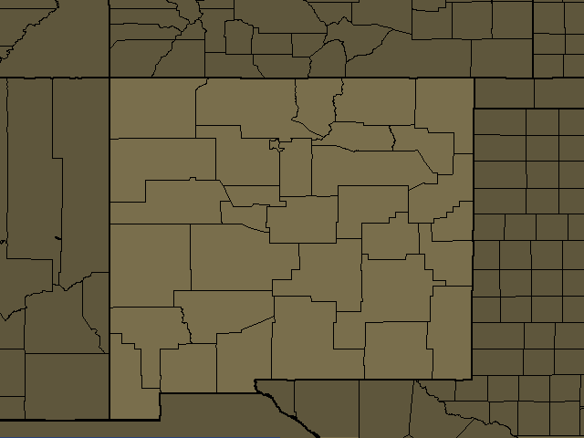
Spurgeon Draw Tanks, NM Regional Weather
Spurgeon Draw Tanks, NM
Day: Windy. Mostly cloudy with showers and scattered thunderstorms. Some thunderstorms may produce heavy rainfall late this morning. Some thunderstorms may be severe with heavy rainfall this afternoon. Highs in the upper 50s. Temperature falling into the lower 50s this afternoon. South winds 25 to 35 mph with gusts up to 50 mph. Chance of rain 90 percent.
Night: Windy. Partly cloudy in the evening, then becoming mostly cloudy. Isolated thunderstorms in the evening. Scattered showers. Some thunderstorms may be severe with heavy rainfall. Lows around 40. Southwest winds 20 to 30 mph with gusts up to 45 mph. Chance of rain 50 percent.
Glenwood, NM
Day: Breezy. Cloudy with showers. Scattered thunderstorms. Some thunderstorms may produce heavy rainfall late this morning. Some thunderstorms may be severe with heavy rainfall this afternoon. Highs around 60. South winds 15 to 25 mph. Chance of rain 90 percent.
Night: Mostly cloudy. Scattered showers in the evening, then numerous showers after midnight. Lows in the mid 40s. Southwest winds 15 to 20 mph. Chance of rain 70 percent.
Cliff, NM
Night: Mostly cloudy. Showers likely, mainly this evening. Breezy with lows in the upper 40s. Southwest winds 15 to 25 mph with gusts up to 35 mph. Chance of rain 70 percent.
Datil, NM
Day: Windy. Partly cloudy late this morning, then becoming mostly cloudy. Isolated showers and thunderstorms late this morning, then numerous showers and scattered thunderstorms this afternoon. Some thunderstorms may be severe this afternoon. Highs in the lower 60s. Temperature falling into the upper 50s this afternoon. South winds 20 to 30 mph. Gusts up to 45 mph this afternoon. Chance of rain 70 percent.
Night: Windy. Partly cloudy. Scattered showers with isolated thunderstorms in the evening, then isolated showers after midnight. Some thunderstorms may be severe. Lows in the mid 40s. Southwest winds 25 to 35 mph with gusts up to 45 mph, diminishing to 20 to 25 mph with gusts up to 35 mph after midnight. Chance of rain 50 percent.
Gallup, NM
Day: Windy. Cloudy with showers. Scattered thunderstorms late this morning, then isolated thunderstorms this afternoon. Some thunderstorms may produce heavy rainfall late this morning. Some thunderstorms may be severe with heavy rainfall this afternoon. Highs around 60. Temperature falling into the mid 50s this afternoon. Southwest winds 20 to 30 mph with gusts up to 40 mph. Chance of rain 90 percent.
Night: Windy. Isolated thunderstorms in the evening. Mostly cloudy with numerous showers. Some thunderstorms may be severe with heavy rainfall. Lows in the upper 30s. Southwest winds 20 to 30 mph with gusts up to 40 mph. Chance of rain 70 percent.
Lake Roberts, NM
Night: Mostly cloudy with showers this evening, then partly cloudy with a chance of showers after midnight. Windy with lows in the mid 40s. Southwest winds 20 to 30 mph with gusts up to 55 mph. Chance of rain 90 percent.
Silver City, NM
Night: Mostly cloudy with showers this evening, then partly cloudy with a chance of showers after midnight. Windy with lows in the mid 40s. West winds 20 to 30 mph with gusts up to 45 mph. Chance of rain 90 percent.
Lordsburg, NM
Night: Partly cloudy. Showers, mainly this evening. Breezy with lows in the upper 40s. Southwest winds 15 to 25 mph with gusts up to 40 mph. Chance of rain 90 percent.
Hurley, NM
Night: Partly cloudy. Showers this evening. Windy with lows in the upper 40s. West winds 20 to 30 mph. Gusts up to 45 mph this evening. Chance of rain 90 percent.
Hillsboro, NM
Night: Partly cloudy with showers with a slight chance of thunderstorms this evening, then mostly clear after midnight. Very windy with lows in the lower 50s. Southwest winds 25 to 35 mph, diminishing to 20 to 25 mph after midnight. Chance of rain 90 percent.
San Carlos, AZ
Night: Showers and a slight chance of thunderstorms in the evening, then a chance of showers and a slight chance of thunderstorms after midnight. Windy. Some thunderstorms may be severe with heavy rainfall in the evening, then heavy rainfall after midnight. Cooler. Lows 44 to 54. Southwest wind 15 to 25 mph. Gusts up to 40 mph. Chance of rain 90 percent. Rainfall up to three quarters of an inch possible, except locally higher in thunderstorms.
West Central Mountains, NM
Day: Windy. Mostly cloudy with showers and scattered thunderstorms. Some thunderstorms may produce heavy rainfall late this morning. Some thunderstorms may be severe with heavy rainfall this afternoon. Highs in the upper 50s. Temperature falling into the lower 50s this afternoon. South winds 20 to 30 mph with gusts up to 40 mph. Caution advised on area lakes. Chance of rain 90 percent.
Night: Windy. Mostly cloudy. Scattered rain showers with isolated thunderstorms in the evening, then numerous rain showers after midnight. Some thunderstorms may be severe with heavy rainfall. Lows in the upper 30s. Southwest winds 20 to 30 mph with gusts up to 40 mph. Chance of rain 70 percent.
Truth or Consequences, NM
Night: Mostly cloudy with showers with a slight chance of thunderstorms this evening, then mostly clear after midnight. Windy with lows in the lower 50s. Southwest winds 20 to 30 mph. Gusts up to 45 mph this evening. Chance of rain 90 percent.
Grants, NM
Day: Breezy. Mostly cloudy. Scattered showers with isolated thunderstorms late this morning, then numerous showers and scattered thunderstorms this afternoon. Some thunderstorms may produce heavy rainfall, then some thunderstorms may be severe with heavy rainfall this afternoon. Highs in the mid 60s. Temperature falling into the upper 50s this afternoon. South winds 15 to 25 mph with gusts up to 35 mph. Chance of rain 70 percent.
Night: Windy. Partly cloudy in the evening, then becoming mostly cloudy. Isolated thunderstorms in the evening. Scattered showers. Some thunderstorms may be severe with heavy rainfall. Lows in the lower 40s. Southwest winds 25 to 30 mph with gusts up to 40 mph, diminishing to 15 to 20 mph after midnight. Chance of rain 50 percent.
Antelope Wells, NM
Night: Partly cloudy with showers with a slight chance of thunderstorms this evening, then mostly clear after midnight. Breezy with lows in the lower 50s. Southwest winds 15 to 25 mph with gusts up to 35 mph. Chance of rain 90 percent.
Globe, AZ
Night: Showers and a slight chance of thunderstorms. Windy. Some thunderstorms may be severe with heavy rainfall in the evening. Heavy rainfall after midnight. Cooler. Lows 41 to 51. Southwest wind 15 to 25 mph in the evening becoming west after midnight. Gusts up to 40 mph. Chance of rain 80 percent. Rainfall up to three quarters of an inch possible, except locally higher in thunderstorms.
Garfield, NM
Night: Mostly cloudy with showers with a chance of thunderstorms this evening, then mostly clear after midnight. Breezy with lows in the lower 50s. Southwest winds 15 to 25 mph with gusts up to 40 mph. Chance of rain 90 percent.
Socorro, NM
Day: Windy. Partly cloudy. Isolated showers and thunderstorms late this morning, then scattered showers and thunderstorms this afternoon. Some thunderstorms may be severe this afternoon. Highs in the lower 70s. South winds 15 to 20 mph, increasing to 20 to 30 mph with gusts up to 40 mph this afternoon. Chance of rain 50 percent.
Night: Windy. Mostly cloudy with scattered showers with isolated thunderstorms in the evening, then partly cloudy with isolated showers after midnight. Some thunderstorms may be severe. Lows around 50. Southwest winds 20 to 30 mph with gusts up to 40 mph, becoming south 15 to 20 mph after midnight. Chance of rain 50 percent.
Deming, NM
Night: Mostly cloudy with showers with a slight chance of thunderstorms this evening, then mostly clear after midnight. Windy with lows in the lower 50s. West winds 20 to 30 mph with gusts up to 40 mph, becoming southwest 15 to 20 mph with gusts up to 30 mph after midnight. Chance of rain 90 percent.
Tortilla Flat, AZ
Night: Showers and a slight chance of thunderstorms in the evening, then partly cloudy with a chance of showers and a slight chance of thunderstorms after midnight. Windy. Some thunderstorms may be severe with heavy rainfall in the evening, then heavy rainfall after midnight. Cooler. Lows 47 to 57. Southwest wind 15 to 25 mph. Gusts up to 40 mph in the evening decreasing to 35 mph after midnight. Chance of rain 90 percent. Rainfall up to an inch possible, except locally higher in thunderstorms.