Newcomb Junior High School, NM Weather Forecast & Current Conditions

Feedback E-mail the Weather

Quick Clicks

Weather World

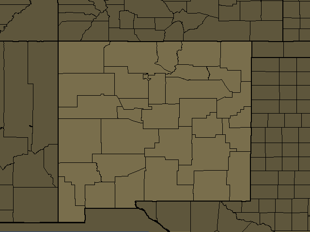
Newcomb Junior High School, NM Weather Maps
°F °C°F °C
Newcomb Junior High School Weather Map
UTC Time: 11/14/2026, 23:24
Your Time:
Aeronautical Observation: Automated synoptic observations via NWS Gateway.
Auto-refresh in: 5:02

Newcomb Junior High School, NM Regional Weather

Expires:202611150000;;834031
ASUS45 KABQ 142310
RWRNM 
NEW MEXICO REGIONAL WEATHER ROUNDUP
NATIONAL WEATHER SERVICE ALBUQUERQUE NM
400 PM MST SAT NOV 14 2026

NOTE: "FAIR" MEANS FEW OR NO CLOUDS BELOW 12,000 FEET AGL WITH NO
       SIGNIFICANT WEATHER OR OBSTRUCTIONS TO VISION.

      THIS PRODUCT IS RELEASED AS TWO VERSIONS.  ONE VERSION NEAR
      THE TOP OF THE HOUR CONTAINING PRELIMINARY DATA FROM ALBUQUERQUE
      AND OTHER STATIONS.  A FINAL VERSION WITH ADDITIONAL DATA IS 
      ISSUED ABOUT 10 MINUTES AFTER THE HOUR.
 

NMZ201-203-204-210>218-150000-
NORTHWEST PLATEAU/NORTHCENTRAL MOUNTAINS
  
CITY           SKY/WX    TMP DP  RH WIND       PRES   REMARKS
FARMINGTON     LGT RAIN  48  39  71 W7        29.91R                  
SANTA FE       MOCLDY    45  40  82 W8        29.93R                  
ANGEL FIRE     LGT SNOW  34  32  93 CALM      29.93S                  

$$

SKY/WX - Weather  TMP - Temperature  DP - Dew Point  RH - Humidity
WIND - Wind Direction/Speed PRES - Barometric Pressure VSB - Visibility
WCI - Wind Chill Index E13G22 Wind - East Wind 13 mph/Gusts of 22 mph

Newcomb Junior High School, NM

Today
Rain Showers
48°/ 32° 9°/ 0°
50%
Sunday
Cloudy
52°/ 32° 11°/ 0°
0%
Monday
Cloudy
55°/ 35° 13°/ 2°
0%
Tuesday
Rain Showers
55°/ 38° 13°/ 3°
100%
Wednesday
Rain Showers
52°/ 32° 11°/ 0°
20%
Thu Night-Fri
Snow Showers
35°2°
50%

Day: Breezy, cooler. Mostly cloudy late this morning, then becoming partly cloudy. A 50 percent chance of showers. Near steady temperature in the upper 40s. West winds 15 to 25 mph with gusts up to 35 mph.

Night: Cooler. Mostly clear. A slight chance of rain showers in the evening. Patchy fog and freezing fog after midnight. Lows in the lower 30s. West winds around 15 mph in the evening. Chance of precipitation 20 percent.

Chuska Mountains, NM

Today
Thunderstorms
38°/ 28° 3°/ -2°
50%
Sunday
Cloudy
48°/ 32° 9°/ 0°
0%
Monday
Cloudy
50°/ 35° 10°/ 2°
0%
Tuesday
Rain Showers
48°/ 32° 9°/ 0°
90%
Wednesday
Snow Showers
42°/ 28° 6°/ -2°
20%
Thu Night
Snow Showers
32°0°
50%
Friday
Snow Showers
40°4°
60%

Day: Breezy, cooler. Mostly cloudy with a chance of rain showers, snow showers with a slight chance of thunderstorms. No snow accumulation. Snow level above 8500 feet. Near steady temperature in the upper 30s. West winds 15 to 25 mph. Chance of precipitation 50 percent.

Night: Cold. Mostly clear. A slight chance of rain and snow showers in the evening. Patchy fog and freezing fog after midnight. Lows in the upper 20s. Chance of precipitation 20 percent.

Gallup, NM

Today
Thunderstorms
45°/ 30° 7°/ -1°
70%
Sunday
Cloudy
52°/ 30° 11°/ -1°
0%
Monday
Sunny
58°/ 35° 14°/ 2°
0%
Tuesday
Rain Showers
52°/ 35° 11°/ 2°
90%
Wednesday
Snow Showers
52°/ 28° 11°/ -2°
20%
Thu Night
Snow Showers
32°0°
20%
Friday
Snow Showers
48°9°
50%

Day: Windy, cooler. Mostly cloudy with showers likely with a slight chance of thunderstorms. Near steady temperature in the mid 40s. West winds 20 to 30 mph with gusts up to 40 mph. Chance of rain 70 percent.

Night: Cold. Partly cloudy. A slight chance of rain showers in the evening. Patchy fog and freezing fog after midnight. Lows around 30. West winds 15 to 20 mph in the evening. Chance of precipitation 20 percent.

West Central Mountains, NM

Today
Thunderstorms
42°/ 28° 6°/ -2°
50%
Sunday
Sunny
52°/ 30° 11°/ -1°
0%
Monday
Sunny
55°/ 32° 13°/ 0°
0%
Tuesday
Cloudy
52°/ 35° 11°/ 2°
70%
Wednesday
Snow Showers
48°/ 28° 9°/ -2°
20%
Thu Night
Snow Showers
32°0°
20%
Friday
Snow Showers
48°9°
50%

Day: Breezy, cooler. Mostly cloudy with a chance of rain showers, a slight chance of thunderstorms and snow showers. Little or no snow accumulation. Near steady temperature in the lower 40s. West winds 15 to 25 mph with gusts up to 35 mph. Caution advised on area lakes. Chance of precipitation 50 percent.

Night: Cold. Partly cloudy with a slight chance of rain and snow showers in the evening, then mostly clear after midnight. Patchy fog and freezing fog after midnight. Lows in the upper 20s. Northwest winds 15 to 20 mph. Chance of precipitation 20 percent.

Cuba, NM

Today
Thunderstorms
42°/ 30° 6°/ -1°
70%
Sunday
Cloudy
50°/ 30° 10°/ -1°
0%
Monday
Sunny
55°/ 32° 13°/ 0°
0%
Tuesday
Cloudy
52°/ 35° 11°/ 2°
90%
Wednesday
Snow Showers
48°/ 30° 9°/ -1°
20%
Thu Night
Snow Showers
35°2°
20%
Friday
Snow Showers
48°9°
50%

Day: Breezy, cooler. Mostly cloudy with a slight chance of snow showers. Showers likely with a slight chance of thunderstorms late this morning, then a chance of showers this afternoon. No snow accumulation. Near steady temperature in the lower 40s. West winds 15 to 25 mph. Chance of precipitation 70 percent.

Night: Cold. Partly cloudy. Patchy fog and freezing fog after midnight. Lows around 30. Northwest winds around 15 mph.

Cortez, CO

Tonight
Cloudy
20°-7°
0%
Sunday
Sunny
45°/ 20° 7°/ -7°
0%
Monday
Sunny
50°/ 25° 10°/ -4°
0%
Tuesday
Thunderstorms
50°/ 25° 10°/ -4°
40%
Wednesday
Rain Showers
40°/ 20° 4°/ -7°
50%
Thu Night
Snow Showers
25°-4°
60%
Friday
Snow Showers
40°/ 15° 4°/ -9°
50%
Saturday
Snow Showers
35°2°
20%

Night: Partly cloudy. Lows in the 20s.

Dulce, NM

Today
Snow Showers
42°/ 28° 6°/ -2°
90%
Sunday
Cloudy
50°/ 25° 10°/ -4°
0%
Monday
Sunny
55°/ 28° 13°/ -2°
0%
Tuesday
Rain Showers
52°/ 32° 11°/ 0°
100%
Wednesday
Snow Showers
48°/ 25° 9°/ -4°
50%
Thu Night
Snow Showers
32°0°
50%
Friday
Snow Showers
48°9°
70%

Day: Much cooler. Mostly cloudy with a slight chance of snow showers. Rain showers late this morning, then a chance of rain showers this afternoon. No snow accumulation. Near steady temperature in the lower 40s. West winds around 15 mph. Chance of precipitation 90 percent.

Night: Cold. Partly cloudy. Patchy fog and freezing fog. Lows in the upper 20s. West winds around 15 mph.

Durango, CO

Tonight
Clear
20°-7°
0%
Sunday
Sunny
45°/ 20° 7°/ -7°
0%
Monday
Sunny
50°/ 20° 10°/ -7°
0%
Tuesday
Thunderstorms
45°/ 25° 7°/ -4°
30%
Wednesday
Rain Showers
40°/ 20° 4°/ -7°
50%
Thu Night
Snow Showers
25°-4°
60%
Friday
Snow Showers
40°/ 15° 4°/ -9°
50%
Saturday
Sunny
35°2°
0%

Night: Mostly clear. Lows in the 20s.

Blanding, UT

Tonight
Clear
30°-1°
0%
Sunday
Sunny
50°/ 30° 10°/ -1°
0%
Monday
Partly Cloudy
55°/ 35° 13°/ 2°
0%
Tuesday
Thunderstorms
55°/ 35° 13°/ 2°
60%
Wed-Wed Night
Cloudy
50°10°
0%
Thursday
Partly Cloudy
50°/ 30° 10°/ -1°
40%
Friday
Rain Showers
45°/ 25° 7°/ -4°
50%
Saturday
Sunny
45°7°
0%

Night: Mostly clear. Lows in the 30s.

Silverton, CO

Tonight
Clear
20°-7°
0%
Sunday
Sunny
35°/ 20° 2°/ -7°
0%
Monday
Sunny
35°/ 20° 2°/ -7°
0%
Tuesday
Thunderstorms
30°/ 25° -1°/ -4°
50%
Wednesday
Snow Showers
25°/ 15° -4°/ -9°
60%
Thursday
Snow Showers
30°/ 20° -1°/ -7°
20%
Friday
Snow Showers
25°/ 15° -4°/ -9°
60%
Saturday
Snow Showers
25°-4°
20%

Night: Mostly clear. Lows in the 20s.

Grants, NM

Today
Thunderstorms
50°/ 32° 10°/ 0°
50%
Sunday
Sunny
55°/ 35° 13°/ 2°
0%
Monday
Sunny
55°/ 35° 13°/ 2°
0%
Tuesday
Cloudy
55°/ 38° 13°/ 3°
50%
Wednesday
Rain Showers
55°/ 32° 13°/ 0°
20%
Thu Night
Cloudy
35°2°
0%
Friday
Snow Showers
55°13°
20%

Day: Breezy. Partly cloudy with a slight chance of thunderstorms. A chance of showers late this morning, then a slight chance of showers this afternoon. Highs around 50. West winds 15 to 25 mph with gusts up to 35 mph. Chance of rain 50 percent.

Night: Partly cloudy with a slight chance of rain showers in the evening, then mostly clear after midnight. Lows in the lower 30s. Northwest winds 15 to 20 mph. Chance of rain 20 percent.

Pagosa Springs, CO

Tonight
Cloudy
15°-9°
0%
Sunday
Sunny
45°/ 15° 7°/ -9°
0%
Monday
Sunny
45°/ 15° 7°/ -9°
0%
Tuesday
Thunderstorms
45°/ 25° 7°/ -4°
20%
Wednesday
Snow Showers
35°/ 15° 2°/ -9°
70%
Thu Night
Snow Showers
20°-7°
70%
Friday
Snow Showers
35°/ 15° 2°/ -9°
60%
Saturday
Snow Showers
35°2°
30%

Night: Partly cloudy. Lows 15 to 25.

Los Alamos, NM

Today
Thunderstorms
40°/ 28° 4°/ -2°
70%
Sunday
Sunny
48°/ 28° 9°/ -2°
0%
Monday
Sunny
50°/ 32° 10°/ 0°
0%
Tuesday
Cloudy
48°/ 32° 9°/ 0°
90%
Wednesday
Snow Showers
45°/ 28° 7°/ -2°
40%
Thu Night
Snow Showers
32°0°
20%
Friday
Snow Showers
45°7°
50%

Day: Cooler. Mostly cloudy with a chance of snow showers with a slight chance of thunderstorms. Rain showers likely late this morning, then a chance of rain showers this afternoon. Snow accumulation up to 2 inches. Snow level 8500 feet. Near steady temperature around 40. West winds 15 to 20 mph. Chance of precipitation 70 percent.

Night: Cold. Partly cloudy in the evening, then becoming mostly clear. Patchy fog and freezing fog. Lows in the upper 20s. Northwest winds 15 to 20 mph.

Spanish Valley, UT

Tonight
Cloudy
25°-4°
0%
Sunday
Partly Cloudy
40°/ 25° 4°/ -4°
0%
Monday
Partly Cloudy
40°/ 25° 4°/ -4°
0%
Tuesday
Thunderstorms
35°/ 25° 2°/ -4°
60%
Wednesday
Snow Showers
35°/ 25° 2°/ -4°
20%
Thursday
Snow Showers
35°/ 25° 2°/ -4°
70%
Friday
Snow Showers
30°/ 15° -1°/ -9°
40%
Saturday
Sunny
30°-1°
0%

Night: Partly cloudy. Lows 25 to 35.

Espanola, NM

Today
Thunderstorms
45°/ 32° 7°/ 0°
100%
Sunday
Sunny
55°/ 30° 13°/ -1°
0%
Monday
Sunny
55°/ 32° 13°/ 0°
0%
Tuesday
Cloudy
58°/ 35° 14°/ 2°
90%
Wednesday
Snow Showers
52°/ 28° 11°/ -2°
50%
Thu Night
Rain Showers
35°2°
20%
Friday
Snow Showers
55°13°
50%

Day: Cooler. A slight chance of thunderstorms. Rain showers late this morning, then a chance of rain showers with a slight chance of snow showers this afternoon. No snow accumulation. Near steady temperature in the mid 40s. Southwest winds around 15 mph. Chance of precipitation near 100 percent.

Night: Cold. Partly cloudy in the evening, then becoming mostly clear. Patchy fog. Lows in the lower 30s. Northwest winds around 15 mph.

Telluride, CO

Tonight
Snow Showers
15°-9°
30%
Sunday
Sunny
35°/ 15° 2°/ -9°
0%
Monday
Sunny
45°/ 15° 7°/ -9°
0%
Tuesday
Snow Showers
40°/ 20° 4°/ -7°
30%
Wednesday
Snow Showers
35°/ 10° 2°/ -12°
40%
Thursday
Snow Showers
35°/ 15° 2°/ -9°
70%
Friday
Snow Showers
30°/ 10° -1°/ -12°
70%
Saturday
Snow Showers
30°-1°
30%

Night: Mostly cloudy with a chance of snow showers in the evening, then partly cloudy after midnight. Lows 15 to 25. Chance of snow 30 percent.

Albuquerque, NM

Today
Thunderstorms
52°/ 35° 11°/ 2°
50%
Sunday
Sunny
58°/ 35° 14°/ 2°
0%
Monday
Sunny
58°/ 35° 14°/ 2°
0%
Tuesday
Cloudy
60°/ 38° 16°/ 3°
50%
Wednesday
Rain Showers
58°/ 35° 14°/ 2°
20%
Thu Night-Fri
Rain Showers
38°3°
20%

Day: Cooler. Mostly cloudy late this morning, then becoming partly cloudy. A chance of showers with a slight chance of thunderstorms. Highs in the lower 50s. Southwest winds around 15 mph, becoming west this afternoon. Chance of rain 50 percent.

Night: Partly cloudy with a slight chance of rain showers in the evening, then mostly clear after midnight. Lows in the mid 30s. Northwest winds around 15 mph. Chance of rain 20 percent.

Gateway, CO

Tonight
Cloudy
25°-4°
0%
Sunday
Sunny
45°/ 25° 7°/ -4°
0%
Monday
Sunny
50°/ 30° 10°/ -1°
0%
Tuesday
Rain Showers
50°/ 30° 10°/ -1°
40%
Wednesday
Rain Showers
40°/ 25° 4°/ -4°
40%
Thursday
Partly Cloudy
45°/ 30° 7°/ -1°
70%
Friday
Snow Showers
40°/ 20° 4°/ -7°
60%
Saturday
Snow Showers
35°2°
20%

Night: Partly cloudy. Lows 25 to 35.

Dead Horse Point State Park, UT

Tonight
Cloudy
30°-1°
0%
Sunday
Sunny
45°/ 30° 7°/ -1°
0%
Monday
Sunny
50°/ 35° 10°/ 2°
0%
Tuesday
Thunderstorms
45°/ 30° 7°/ -1°
70%
Wed-Wed Night
Cloudy
40°4°
0%
Thursday
Rain Showers
45°/ 30° 7°/ -1°
60%
Fri Night
Snow Showers
25°-4°
30%
Saturday
Sunny
35°2°
0%

Night: Partly cloudy. Lows in the 30s.

Chama, NM

Today
Snow Showers
35°/ 25° 2°/ -4°
70%
Sunday
Sunny
45°/ 25° 7°/ -4°
0%
Monday
Sunny
48°/ 28° 9°/ -2°
0%
Tuesday
Rain Showers
45°/ 30° 7°/ -1°
70%
Wednesday
Snow Showers
38°/ 25° 3°/ -4°
50%
Thu Night
Snow Showers
28°-2°
50%
Friday
Snow Showers
42°6°
70%

Day: Cooler. Mostly cloudy with snow showers likely. A chance of rain showers late this morning, then a slight chance of rain showers this afternoon. Additional snow accumulation up to 2 inches. Snow level 8500 feet. Near steady temperature in the mid 30s. Southwest winds around 15 mph. Chance of precipitation 70 percent.

Night: Cold. Partly cloudy. Patchy freezing fog. Lows in the mid 20s. Northwest winds around 15 mph.

Names listed above may include county names.

Trending Headlines

Trending Entertainment Headlines

Newcomb Junior High School Radar Loop

Use the map search tool if you want to place a location marker on the radar map...

Newcomb Junior High School Quick Facts

National Two Day Weather Forecast


E-mail the Newcomb Junior High School Weather Forecast

Voice your opinion or tell us about page issues...