 Weather World

Spoede School, MO Weather Maps
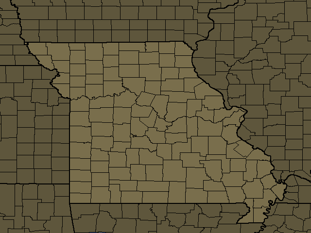
Spoede School, MO Regional Weather
Spoede School, MO
Day: Partly sunny. A chance of showers and thunderstorms. Highs in the mid 90s. Southwest winds around 5 mph. Chance of rain 50 percent. Heat index values up to 106.
Night: Partly cloudy with a chance of showers and thunderstorms in the evening, then mostly clear after midnight. Humid with lows in the mid 70s. South winds around 5 mph. Chance of rain 30 percent.
Saint Louis City, MO
Day: Partly sunny. A chance of showers and thunderstorms. Highs in the mid 90s. Southwest winds around 5 mph. Chance of rain 50 percent. Heat index values up to 106.
Night: Partly cloudy with a chance of showers and thunderstorms in the evening, then mostly clear after midnight. Humid with lows in the mid 70s. South winds around 5 mph. Chance of rain 30 percent.
Saint Charles, MO
Day: Partly sunny. A chance of showers and thunderstorms. Highs in the mid 90s. Southwest winds around 5 mph. Chance of rain 50 percent. Heat index values up to 106.
Night: Partly cloudy with a chance of showers and thunderstorms in the evening, then mostly clear after midnight. Humid with lows in the mid 70s. South winds around 5 mph. Chance of rain 30 percent.
Monroe, MO
Day: Mostly sunny. A chance of showers and thunderstorms. Hot with highs in the mid 90s. South winds around 5 mph. Chance of rain 50 percent. Heat index values up to 108.
Night: Partly cloudy with a chance of showers and thunderstorms in the evening, then mostly clear after midnight. Lows in the lower 70s. South winds around 5 mph. Chance of rain 30 percent. Heat index values up to 100 early in the evening.
Saint Clair, IL
Day: Partly sunny. A chance of showers and thunderstorms. Highs in the mid 90s. Southwest winds around 5 mph. Chance of rain 50 percent. Heat index values up to 106.
Night: Partly cloudy with a chance of showers and thunderstorms in the evening, then mostly clear after midnight. Humid with lows in the mid 70s. South winds around 5 mph. Chance of rain 30 percent.
Madison, IL
Day: Partly sunny. A chance of showers and thunderstorms. Highs in the mid 90s. Southwest winds around 5 mph. Chance of rain 50 percent. Heat index values up to 106.
Night: Partly cloudy with a chance of showers and thunderstorms in the evening, then mostly clear after midnight. Humid with lows in the mid 70s. South winds around 5 mph. Chance of rain 30 percent.
Monroe, IL
Day: Mostly sunny. A chance of showers and thunderstorms. Hot with highs in the mid 90s. South winds around 5 mph. Chance of rain 50 percent. Heat index values up to 108.
Night: Partly cloudy with a chance of showers and thunderstorms in the evening, then mostly clear after midnight. Lows in the lower 70s. South winds around 5 mph. Chance of rain 30 percent. Heat index values up to 100 early in the evening.
Greene, IL
Day: Partly sunny. A slight chance of showers early. Highs in the lower 90s. East winds around 5 mph, becoming west. Chance of rain 20 percent. Heat index values up to 101.
Night: Partly cloudy with a slight chance of showers and thunderstorms in the evening, then mostly clear after midnight. Humid with lows in the lower 70s. Southeast winds around 5 mph. Chance of rain 20 percent.
Franklin, MO
Day: Mostly sunny. A chance of showers and thunderstorms. Highs in the mid 90s. South winds around 5 mph. Chance of rain 50 percent. Heat index values up to 106.
Night: Partly cloudy with a chance of showers and thunderstorms in the evening, then mostly clear after midnight. Lows in the lower 70s. South winds around 5 mph. Chance of rain 30 percent.
Montgomery, MO
Day: Mostly sunny. Highs in the lower 90s. Northeast winds around 5 mph, becoming southeast around 5 mph. Heat index values up to 104.
Night: Partly cloudy with a slight chance of showers and thunderstorms in the evening, then mostly clear after midnight. Humid with lows in the lower 70s. Southeast winds around 5 mph. Chance of rain 20 percent.
Warren, MO
Day: Mostly sunny. A slight chance of showers and thunderstorms. Highs in the lower 90s. Light and variable winds, becoming south around 5 mph. Chance of rain 20 percent. Heat index values up to 106.
Night: Partly cloudy with a chance of showers and thunderstorms in the evening, then mostly clear after midnight. Humid with lows in the lower 70s. Light and variable winds, becoming south around 5 mph after midnight. Chance of rain 30 percent.
Randolph, IL
Day: Mostly sunny. A chance of showers and thunderstorms. Hot with highs in the mid 90s. South winds around 5 mph. Chance of rain 50 percent. Heat index values up to 107.
Night: Partly cloudy with a chance of showers and thunderstorms in the evening, then mostly clear after midnight. Lows in the lower 70s. South winds around 5 mph. Chance of rain 30 percent.
Clinton, IL
Day: Mostly sunny. A chance of showers and thunderstorms. Hot with highs in the mid 90s. Southwest winds 5 to 10 mph. Chance of rain 50 percent. Heat index values up to 106.
Night: Partly cloudy with a chance of showers and thunderstorms in the evening, then mostly clear after midnight. Lows in the mid 70s. South winds around 5 mph. Chance of rain 40 percent. Heat index values up to 101 early in the evening.
Washington, MO
Day: Mostly sunny. A chance of showers and thunderstorms. Highs in the mid 90s. South winds around 5 mph. Chance of rain 50 percent. Heat index values up to 106.
Night: Partly cloudy with a chance of showers and thunderstorms in the evening, then mostly clear after midnight. Lows in the lower 70s. South winds around 5 mph. Chance of rain 30 percent.
Saint Francois, MO
Day: Sunny. A slight chance of showers and thunderstorms. Hot with highs in the mid 90s. South winds around 5 mph. Chance of rain 20 percent. Heat index values up to 104.
Night: Mostly clear. Lows in the lower 70s. South winds around 5 mph.
Washington, IL
Day: Mostly sunny. A chance of showers and thunderstorms. Hot with highs in the mid 90s. Southwest winds 5 to 10 mph. Chance of rain 50 percent. Heat index values up to 106.
Night: Partly cloudy with a chance of showers and thunderstorms in the evening, then mostly clear after midnight. Lows in the mid 70s. South winds around 5 mph. Chance of rain 40 percent. Heat index values up to 101 early in the evening.
Sainte Genevieve, MO
Day: Mostly sunny. A chance of showers and thunderstorms. Hot with highs in the mid 90s. South winds around 5 mph. Chance of rain 50 percent. Heat index values up to 107.
Night: Partly cloudy with a chance of showers and thunderstorms in the evening, then mostly clear after midnight. Lows in the lower 70s. South winds around 5 mph. Chance of rain 30 percent.
Bond, IL
Day: Partly sunny. A chance of showers and thunderstorms. Highs in the mid 90s. Southwest winds around 5 mph. Chance of rain 40 percent. Heat index values up to 104.
Night: Partly cloudy. A chance of showers and thunderstorms in the evening. Humid with lows in the lower 70s. South winds around 5 mph in the evening, becoming light and variable. Chance of rain 30 percent. Heat index values up to 100 early in the evening.
Adams, MO
Day: Partly sunny with a 50 percent chance of showers. Highs in the mid 80s. East winds around 5 mph.
Night: Partly cloudy. Humid with lows in the lower 70s. East winds around 5 mph, becoming southeast after midnight.
Montgomery, IL
Day: Partly sunny. A slight chance of showers early, then a chance of showers and thunderstorms. Highs in the lower 90s. South winds around 5 mph, becoming west. Chance of rain 40 percent. Heat index values up to 102.
Night: Partly cloudy. A chance of showers and thunderstorms in the evening. Lows in the lower 70s. East winds around 5 mph, becoming south after midnight. Chance of rain 30 percent.