 Weather World

West Side Tank South, NM Weather Maps
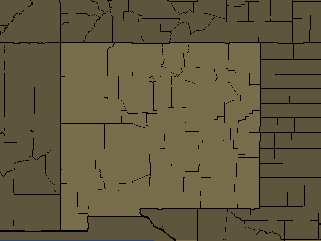
West Side Tank South, NM Regional Weather
West Side Tank South, NM
Night: Showers with a slight chance of thunderstorms. Some thunderstorms may produce heavy rainfall. Near steady temperature in the upper 50s. South winds around 15 mph. Chance of rain near 100 percent.
Quemado, NM
Night: Showers with a slight chance of thunderstorms. Some thunderstorms may produce heavy rainfall. Near steady temperature in the lower 50s. South winds 15 to 20 mph. Chance of rain near 100 percent.
Cliff, NM
Day: Showers with a chance of thunderstorms. Some thunderstorms may produce heavy rainfall. Cooler with highs in the mid 60s. South winds 10 to 15 mph with gusts up to 25 mph. Chance of rain near 100 percent.
Night: Showers with a chance of thunderstorms in the evening, then partly cloudy with a chance of showers after midnight. Some thunderstorms may produce heavy rainfall in the evening. Lows in the lower 50s. Southwest winds 10 to 15 mph, becoming west 5 to 10 mph after midnight. Chance of rain near 100 percent.
Datil, NM
Night: Showers with a slight chance of thunderstorms. Some thunderstorms may produce heavy rainfall. Near steady temperature in the mid 50s. South winds 15 to 20 mph. Chance of rain near 100 percent.
Lake Roberts, NM
Day: Showers with a chance of thunderstorms. Some thunderstorms may produce heavy rainfall. Cooler with highs around 60. South winds 10 to 15 mph with gusts up to 25 mph. Chance of rain near 100 percent.
Night: Showers with a chance of thunderstorms in the evening, then partly cloudy with a chance of showers after midnight. Some thunderstorms may produce heavy rainfall in the evening. Lows in the upper 40s. South winds 10 to 15 mph, becoming west 15 to 20 mph after midnight. Gusts up to 35 mph. Chance of rain near 100 percent.
Silver City, NM
Day: Showers with a chance of thunderstorms. Some thunderstorms may produce heavy rainfall. Cooler with highs in the lower 60s. South winds 5 to 10 mph with gusts up to 25 mph. Chance of rain near 100 percent.
Night: Showers with a chance of thunderstorms in the evening, then partly cloudy with a slight chance of showers after midnight. Some thunderstorms may produce heavy rainfall in the evening. Lows around 50. Southwest winds 10 to 15 mph, becoming west after midnight. Gusts up to 30 mph. Chance of rain near 100 percent.
Lordsburg, NM
Day: Showers with a chance of thunderstorms. Some thunderstorms may produce heavy rainfall. Cooler with highs around 70. South winds 10 to 15 mph with gusts up to 25 mph. Chance of rain near 100 percent.
Night: Showers with a chance of thunderstorms in the evening, then a slight chance of showers after midnight. Some thunderstorms may produce heavy rainfall in the evening. Lows in the lower 50s. Southwest winds 10 to 15 mph. Gusts up to 30 mph in the evening. Chance of rain near 100 percent.
Hurley, NM
Day: Showers with a chance of thunderstorms. Some thunderstorms may produce heavy rainfall. Cooler with highs in the mid 60s. South winds 5 to 10 mph. Chance of rain near 100 percent.
Night: Mostly cloudy with showers with a chance of thunderstorms in the evening, then partly cloudy with a slight chance of showers after midnight. Some thunderstorms may produce heavy rainfall in the evening. Lows in the lower 50s. Southwest winds 10 to 15 mph, becoming west after midnight. Gusts up to 30 mph. Chance of rain 90 percent.
Gallup, NM
Night: Showers with a slight chance of thunderstorms. Some thunderstorms may produce heavy rainfall. Near steady temperature in the lower 50s. Southeast winds around 15 mph. Chance of rain near 100 percent.
Hillsboro, NM
Day: Showers with a slight chance of thunderstorms this morning, then showers with a chance of thunderstorms this afternoon. Some thunderstorms may produce heavy rainfall. Locally heavy rainfall possible this afternoon. Cooler with highs in the upper 60s. South winds 10 to 15 mph. Chance of rain near 100 percent.
Night: Mostly cloudy with showers with a chance of thunderstorms in the evening, then mostly clear with a slight chance of showers after midnight. Some thunderstorms may produce heavy rainfall in the evening. Lows in the lower 50s. Southeast winds 10 to 15 mph, becoming southwest after midnight. Gusts up to 30 mph. Chance of rain 90 percent.
Truth Or Consequences, NM
Day: Showers. A slight chance of thunderstorms this morning, then a chance of thunderstorms this afternoon. Some thunderstorms may produce heavy rainfall this morning. Some thunderstorms may produce heavy rainfall this afternoon. Cooler with highs in the upper 60s. South winds 10 to 15 mph with gusts up to 25 mph. Chance of rain near 100 percent.
Night: Showers with a chance of thunderstorms in the evening, then partly cloudy with a slight chance of showers after midnight. Some thunderstorms may produce heavy rainfall in the evening. Lows in the lower 50s. North winds 10 to 15 mph, becoming southwest 15 to 20 mph after midnight. Chance of rain near 100 percent.
San Carlos, AZ
Day: Showers and a chance of thunderstorms. Heavy rainfall and cooler. Highs 63 to 73. Southeast wind 5 to 10 mph. Chance of rain near 100 percent. Rainfall over an inch possible, except locally higher in thunderstorms.
Night: Showers and a chance of thunderstorms in the evening, then showers likely and a slight chance of thunderstorms after midnight. Heavy rainfall in the evening. Cooler. Lows 49 to 59. Southwest wind around 5 mph in the evening becoming light after midnight. Chance of rain 80 percent. Rainfall less than a quarter of an inch, except locally higher in thunderstorms.
West Central Mountains, NM
Night: Showers with a slight chance of thunderstorms. Some thunderstorms may produce heavy rainfall. Near steady temperature around 50. Chance of rain near 100 percent.
Antelope Wells, NM
Day: Showers. A slight chance of thunderstorms this morning, then a chance of thunderstorms this afternoon. Some thunderstorms may produce heavy rainfall this morning. Some thunderstorms may produce heavy rainfall this afternoon. Cooler with highs in the lower 70s. South winds 5 to 10 mph with gusts up to 20 mph. Chance of rain near 100 percent.
Night: Partly cloudy with showers likely with a chance of thunderstorms in the evening, then mostly clear after midnight. Some thunderstorms may produce heavy rainfall in the evening. Lows in the mid 50s. Southwest winds 15 to 20 mph with gusts up to 30 mph. Chance of rain 70 percent.
Garfield, NM
Day: Showers with a slight chance of thunderstorms this morning, then showers with a chance of thunderstorms this afternoon. Some thunderstorms may produce heavy rainfall this morning. Some thunderstorms may produce heavy rainfall this afternoon. Cooler with highs in the lower 70s. South winds 5 to 10 mph with gusts up to 20 mph. Chance of rain 90 percent.
Night: Showers with a chance of thunderstorms in the evening, then partly cloudy with a chance of showers after midnight. Some thunderstorms may produce heavy rainfall in the evening. Lows in the mid 50s. Northwest winds 10 to 15 mph, becoming southwest 15 to 20 mph after midnight. Chance of rain near 100 percent.
Deming, NM
Day: Showers. A slight chance of thunderstorms this morning, then a chance of thunderstorms this afternoon. Some thunderstorms may produce heavy rainfall this morning. Some thunderstorms may produce heavy rainfall this afternoon. Cooler with highs in the lower 70s. Southeast winds 5 to 10 mph. Chance of rain near 100 percent.
Night: Mostly cloudy with showers likely with a chance of thunderstorms in the evening, then mostly clear after midnight. Some thunderstorms may produce heavy rainfall in the evening. Lows in the mid 50s. West winds 10 to 15 mph with gusts up to 30 mph. Chance of rain 70 percent.
Globe, AZ
Day: Showers and a chance of thunderstorms. Heavy rainfall possible. Highs 61 to 71. Northwest wind 5 to 10 mph in the morning becoming south in the afternoon. Chance of rain near 100 percent. Rainfall over an inch possible, except locally higher in thunderstorms.
Night: Showers likely with a chance of thunderstorms in the evening, then showers likely and a slight chance of thunderstorms after midnight. Heavy rainfall in the evening. Cooler. Lows 46 to 56. Southwest wind around 5 mph in the evening becoming southeast after midnight. Chance of rain 60 percent. Rainfall around a tenth of an inch, except locally higher in thunderstorms.
Socorro, NM
Night: Showers with a slight chance of thunderstorms. Some thunderstorms may produce heavy rainfall. Near steady temperature in the lower 60s. South winds 15 to 20 mph. Chance of rain near 100 percent.
Grants, NM
Night: Showers with a slight chance of thunderstorms. Some thunderstorms may produce heavy rainfall. Near steady temperature in the mid 50s. Chance of rain near 100 percent.
Tortilla Flat, AZ
Day: Showers and a chance of thunderstorms. Heavy rainfall possible. Highs 73 to 78. North wind 5 to 10 mph in the morning becoming southwest in the afternoon. Chance of rain near 100 percent. Rainfall over an inch possible, except locally higher in thunderstorms.
Night: Considerable cloudiness with a chance of showers and thunderstorms in the evening, then partly cloudy with a chance of showers and a slight chance of thunderstorms after midnight. Heavy rainfall in the evening. Cooler. Lows 52 to 62. South wind around 5 mph. Chance of rain 50 percent. Rainfall less than a quarter of an inch, except locally higher in thunderstorms.