 Weather World

Soda Dam Historical Marker, NM Weather Maps
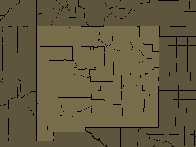
Soda Dam Historical Marker, NM Regional Weather
Soda Dam Historical Marker, NM
Day: Breezy. Partly cloudy with scattered showers and thunderstorms. Some thunderstorms may produce heavy rainfall. Near steady temperature in the upper 60s. South winds 20 to 25 mph with gusts up to 35 mph. Caution advised on area lakes. Chance of rain 50 percent.
Night: Breezy. Mostly cloudy. Showers and scattered thunderstorms in the evening, then numerous showers with isolated thunderstorms after midnight. Some thunderstorms may produce heavy rainfall in the evening. Some thunderstorms may produce heavy rainfall after midnight. Lows in the lower 50s. South winds 20 to 25 mph with gusts up to 35 mph, becoming southeast around 15 mph after midnight. Chance of rain 90 percent.
Cuba, NM
Day: Mostly cloudy with numerous showers and scattered thunderstorms. Some thunderstorms may produce heavy rainfall. Near steady temperature in the lower 70s. South winds 15 to 20 mph. Chance of rain 70 percent.
Night: Mostly cloudy. Numerous showers and scattered thunderstorms in the evening, then scattered showers with isolated thunderstorms after midnight. Some thunderstorms may produce heavy rainfall. Lows in the lower 50s. Southeast winds around 15 mph in the evening. Chance of rain 70 percent.
Albuquerque, NM
Day: Partly cloudy with scattered showers and thunderstorms. Some thunderstorms may produce heavy rainfall. Highs in the lower 80s. South winds 15 to 20 mph. Chance of rain 50 percent.
Night: Mostly cloudy with numerous showers. Scattered thunderstorms, mainly in the evening. Some thunderstorms may produce heavy rainfall in the evening. Some thunderstorms may produce heavy rainfall after midnight. Lows in the upper 50s. Southeast winds around 15 mph in the evening. Chance of rain 70 percent.
Santa Fe, NM
Day: Mostly cloudy with numerous showers and scattered thunderstorms. Some thunderstorms may produce heavy rainfall. Near steady temperature in the mid 70s. South winds 15 to 20 mph. Chance of rain 70 percent.
Night: Mostly cloudy. Showers and scattered thunderstorms in the evening, then numerous showers with isolated thunderstorms after midnight. Some thunderstorms may produce heavy rainfall in the evening. Some thunderstorms may produce heavy rainfall after midnight. Lows in the upper 50s. Southeast winds around 15 mph in the evening. Chance of rain 80 percent.
Espanola, NM
Day: Partly cloudy with scattered showers and thunderstorms. Some thunderstorms may produce heavy rainfall. Highs in the mid 70s. South winds 15 to 20 mph. Chance of rain 50 percent.
Night: Mostly cloudy. Showers and scattered thunderstorms in the evening, then numerous showers with isolated thunderstorms after midnight. Areas of fog after midnight. Some thunderstorms may produce heavy rainfall in the evening. Some thunderstorms may produce heavy rainfall after midnight. Lows in the mid 50s. South winds around 15 mph in the evening. Chance of rain 90 percent.
Dulce, NM
Day: Mostly cloudy with numerous showers and thunderstorms. Some thunderstorms may produce heavy rainfall. Highs around 70. South winds 15 to 20 mph. Chance of rain 70 percent.
Night: Mostly cloudy. Showers and scattered thunderstorms in the evening, then scattered showers with isolated thunderstorms after midnight. Areas of fog after midnight. Some thunderstorms may produce heavy rainfall. Lows in the upper 40s. Southeast winds around 15 mph in the evening. Chance of rain 90 percent.
Edgewood Sandia Park, NM
Day: Partly cloudy with scattered showers and thunderstorms. Some thunderstorms may produce heavy rainfall. Highs in the upper 70s. South winds 15 to 20 mph. Chance of rain 50 percent.
Night: Mostly cloudy with numerous showers. Scattered thunderstorms, mainly in the evening. Areas of fog after midnight. Some thunderstorms may produce heavy rainfall in the evening. Some thunderstorms may produce heavy rainfall after midnight. Lows in the mid 50s. South winds 15 to 20 mph. Chance of rain 70 percent.
Glorieta Pass Pecos, NM
Day: Mostly cloudy with showers and scattered thunderstorms. Some thunderstorms may produce heavy rainfall. Highs in the lower 70s. Temperature falling into the upper 60s this afternoon. South winds around 15 mph. Chance of rain 90 percent.
Night: Mostly cloudy. Showers and scattered thunderstorms in the evening, then numerous showers with isolated thunderstorms after midnight. Some thunderstorms may produce heavy rainfall in the evening. Some thunderstorms may produce heavy rainfall after midnight. Lows in the lower 50s. South winds around 15 mph in the evening. Chance of rain 80 percent.
Southern Sangre de Cristo Mountains, NM
Day: Mostly cloudy with numerous showers and scattered thunderstorms. Some thunderstorms may produce heavy rainfall. Highs in the lower 60s. Southwest winds 15 to 20 mph. Chance of rain 70 percent.
Night: Scattered thunderstorms in the evening. Mostly cloudy with numerous showers. Some thunderstorms may produce heavy rainfall in the evening. Lows in the upper 40s. South winds around 15 mph. Chance of rain 70 percent.
Grants, NM
Day: Partly cloudy with numerous showers and scattered thunderstorms. Some thunderstorms may produce heavy rainfall. Highs in the upper 70s. South winds 15 to 20 mph. Chance of rain 70 percent.
Night: Mostly cloudy with numerous showers. Scattered thunderstorms, mainly in the evening. Some thunderstorms may produce heavy rainfall in the evening. Some thunderstorms may produce heavy rainfall after midnight. Lows in the upper 50s. South winds around 15 mph. Chance of rain 70 percent.
Chama Chama, NM
Day: Mostly cloudy with numerous showers and scattered thunderstorms. Some thunderstorms may produce heavy rainfall. Highs in the mid 60s. South winds 15 to 20 mph. Chance of rain 70 percent.
Night: Mostly cloudy. Showers and scattered thunderstorms in the evening, then scattered showers with isolated thunderstorms after midnight. Some thunderstorms may produce heavy rainfall. Lows in the upper 40s. South winds 15 to 20 mph. Chance of rain 90 percent.
Moriarty, NM
Day: Partly cloudy with scattered showers and thunderstorms. Highs around 80. South winds 15 to 20 mph. Chance of rain 50 percent.
Night: Partly cloudy in the evening, then becoming mostly cloudy. Scattered showers. Scattered thunderstorms, mainly in the evening. Areas of fog after midnight. Lows in the lower 50s. South winds around 15 mph in the evening. Chance of rain 50 percent.
Questa, NM
Day: Breezy. Partly cloudy with scattered showers and thunderstorms. Some thunderstorms may produce heavy rainfall. Highs in the lower 70s. Southwest winds 20 to 25 mph. Chance of rain 50 percent.
Night: Mostly cloudy. Showers and scattered thunderstorms in the evening, then scattered showers after midnight. Areas of fog after midnight. Some thunderstorms may produce heavy rainfall in the evening. Lows in the upper 40s. South winds around 15 mph in the evening. Chance of rain 80 percent.
West Central Mountains, NM
Day: Mostly cloudy with numerous showers and scattered thunderstorms. Near steady temperature around 70. South winds 15 to 20 mph. Chance of rain 70 percent.
Night: Partly cloudy in the evening, then becoming mostly cloudy. Scattered thunderstorms in the evening. Scattered showers. Lows in the lower 50s. South winds around 15 mph. Chance of rain 50 percent.
Clines Corners, NM
Day: Mostly cloudy with numerous showers and scattered thunderstorms. Highs in the upper 70s. South winds around 15 mph. Chance of rain 70 percent.
Night: Mostly cloudy in the evening, then becoming partly cloudy. Scattered showers. Scattered thunderstorms, mainly in the evening. Lows in the mid 50s. South winds around 15 mph in the evening. Chance of rain 50 percent.
Angel Fire, NM
Day: Breezy. Mostly cloudy with numerous showers and scattered thunderstorms. Some thunderstorms may produce heavy rainfall. Highs in the lower 70s. Southwest winds 20 to 25 mph with gusts up to 35 mph. Caution advised on area lakes. Chance of rain 70 percent.
Night: Isolated thunderstorms in the evening. Mostly cloudy with scattered showers. Some thunderstorms may produce heavy rainfall in the evening. Lows in the lower 50s. Southwest winds 15 to 20 mph. Chance of rain 50 percent.
Las Vegas, NM
Day: Mostly cloudy with scattered showers and thunderstorms. Highs in the upper 70s. South winds 15 to 20 mph. Chance of rain 50 percent.
Night: Mostly cloudy in the evening, then becoming partly cloudy. Scattered thunderstorms in the evening. Scattered showers. Lows in the mid 50s. Southwest winds 15 to 20 mph. Chance of rain 50 percent.
Red River, NM
Day: Mostly cloudy with numerous showers and scattered thunderstorms. Some thunderstorms may produce heavy rainfall. Highs in the mid 60s. Southwest winds 15 to 20 mph. Chance of rain 70 percent.
Night: Mostly cloudy. Numerous showers with isolated thunderstorms in the evening, then scattered showers after midnight. Some thunderstorms may produce heavy rainfall in the evening. Lows in the mid 40s. Southwest winds 15 to 20 mph. Chance of rain 70 percent.
Raton, NM
Day: Windy. Mostly cloudy with scattered showers and thunderstorms. Highs in the upper 70s. South winds 20 to 30 mph with gusts up to 40 mph. Chance of rain 50 percent.
Night: Mostly cloudy. Scattered showers with isolated thunderstorms in the evening, then isolated showers after midnight. Lows in the mid 50s. Southwest winds 15 to 20 mph. Chance of rain 50 percent.
Farmington, NM
Day: Mostly cloudy with numerous showers and scattered thunderstorms. Some thunderstorms may produce heavy rainfall. Near steady temperature in the lower 70s. South winds around 15 mph. Chance of rain 70 percent.
Night: Partly cloudy. Scattered showers and thunderstorms, mainly in the evening. Some thunderstorms may produce heavy rainfall. Lows in the mid 50s. Chance of rain 50 percent.